TileIQ Help
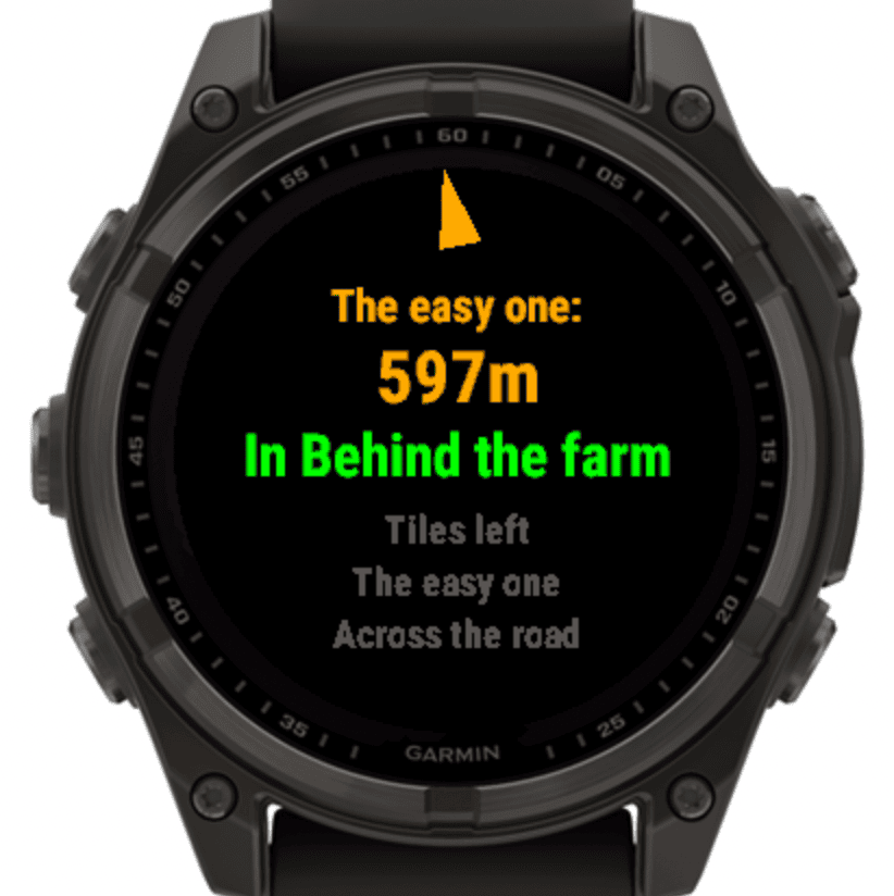
TileIQ has been designed to make tile or squadrats hunting easier.
You can find the data field on the Garmin Connect IQ store here:
TileIQ on Garmin
Connect IQ Store
A demo video showing the data field in action is available on YouTube:
TileIQ Demo Video
How To Sync Your Tiles with TileIQ
For TileIQ to help you get those tiles, you must first generate a list of tiles, and sync it to your Garmin device.
-
Generate Your Tile List
The list of tiles you want to "hunt" must be generated and copied from the TileIQ WebApp:
https://tileiq.itdidhappen.me/There are two ways you can generate your list:
-
Method 1: Hand Pick on the Map
Simply use the map on the TileIQ WebApp to select and manually add each tile you are interested in.
You can make this easier by downloading your KML file from squadrats.com (on the right of the Squadrats map screen) and uploading it on https://tileiq.itdidhappen.me/.
This will overlay your visited tiles and squadratinhos on the map.
Pro tip: The next two options enable you to leverage the Squadrats Chrome extension to easily plan and mark tiles directly within your favourite route builder!
Squadrats Route Planning Chrome Extension-
Method 2: Sync your Strava routes
-
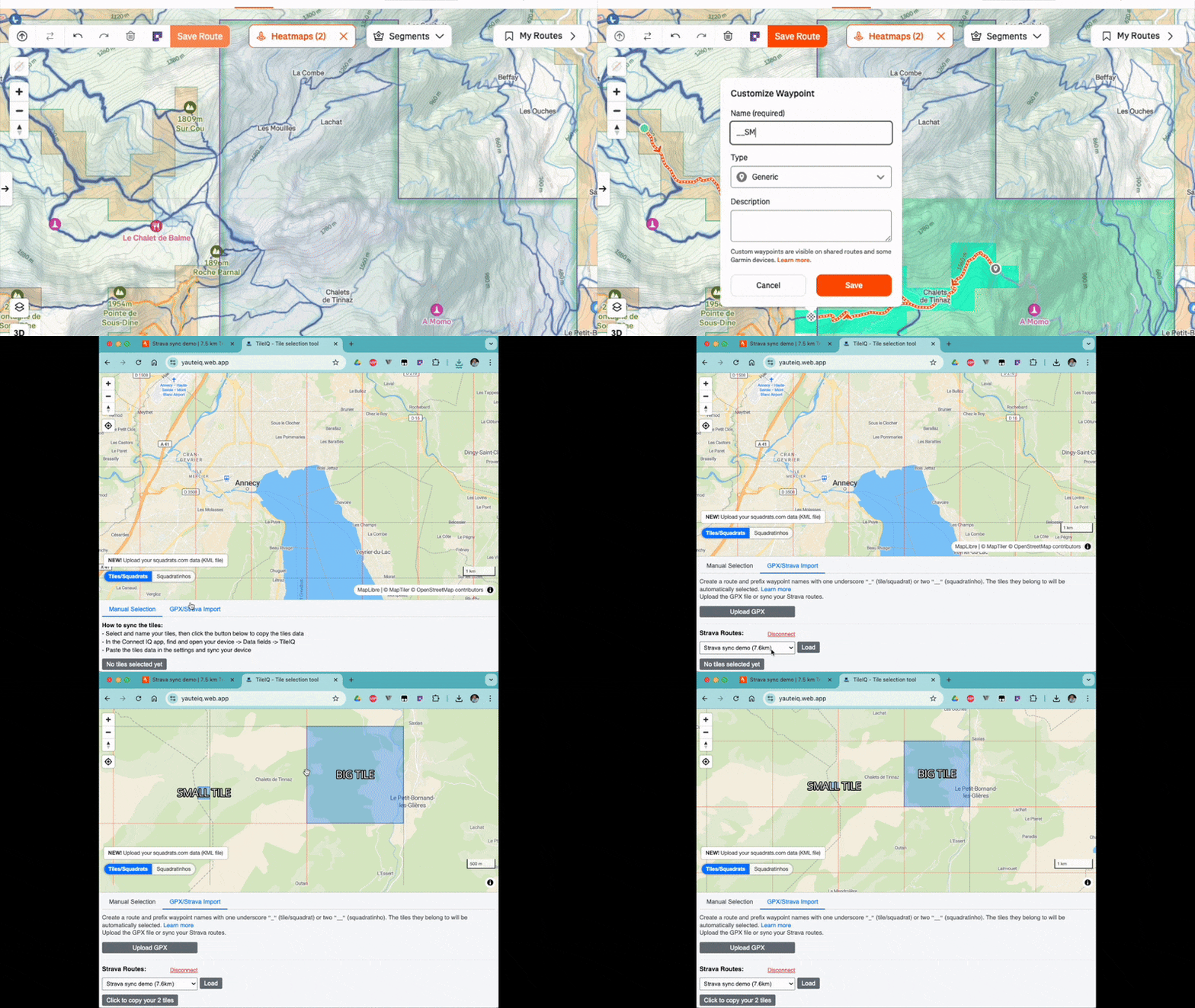
Create a route on Strava, and name waypoints with a name starting with one or two
underscores
(`_` or `__`) to signal your intent:
- One underscore (e.g., `_mytile`): Signals interest in the tile/squadrats the point belongs to.
- Two underscores (e.g., `__mysquadratinho`): Signals interest in the squadratinho the point belongs to.
- Head over to the TileIQ WebApp and the "Strava" tab.
- "Connect with Strava" and pick the route in the drop down. Hit "Load".
- Your tiles are automatically selected, and ready to be copied into TileIQ via ConnectIQ.
-
Create a route on Strava, and name waypoints with a name starting with one or two
underscores
(`_` or `__`) to signal your intent:
-
Method 3: Generate from a GPX file (Strava, Garmin, RideWithGPS)
If your tile or squadrat hunting starts by planning a route in Garmin or RideWithGPS, this should be the best option for you.
-
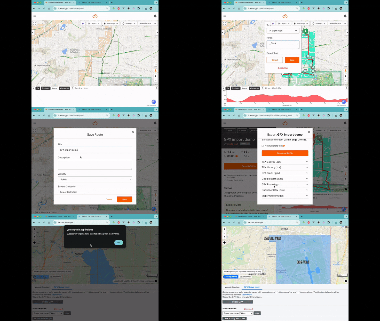
While planning your route, add a point in each of the tile/squadrat/squadratinho you
wish to capture.
- On Garmin Connect, they call it a "Course point"
- On RideWithGPS, they call it a "Cue point"
- On Strava, they call it a "Waypoint"
Unfortunately, Komoot doesn't offer a way to customise waypoints, so this method is not available for Komoot routes. -
Name each point with a name starting with one or two underscores (`_` or `__`) to signal
your intent:
- One underscore (e.g., `_mytile`): Signals interest in the tile/squadrats the point belongs to.
- Two underscores (e.g., `__mysquadratinho`): Signals interest in the squadratinho the point belongs to.
- Export the route as a GPX file (For RideWithGPS: use "GPX Route", not "GPX Track").
- Upload the GPX file to the TileIQ WebApp. The list is automatically generated from your custom points.
-
While planning your route, add a point in each of the tile/squadrat/squadratinho you
wish to capture.
-
-
Copy and Sync the List
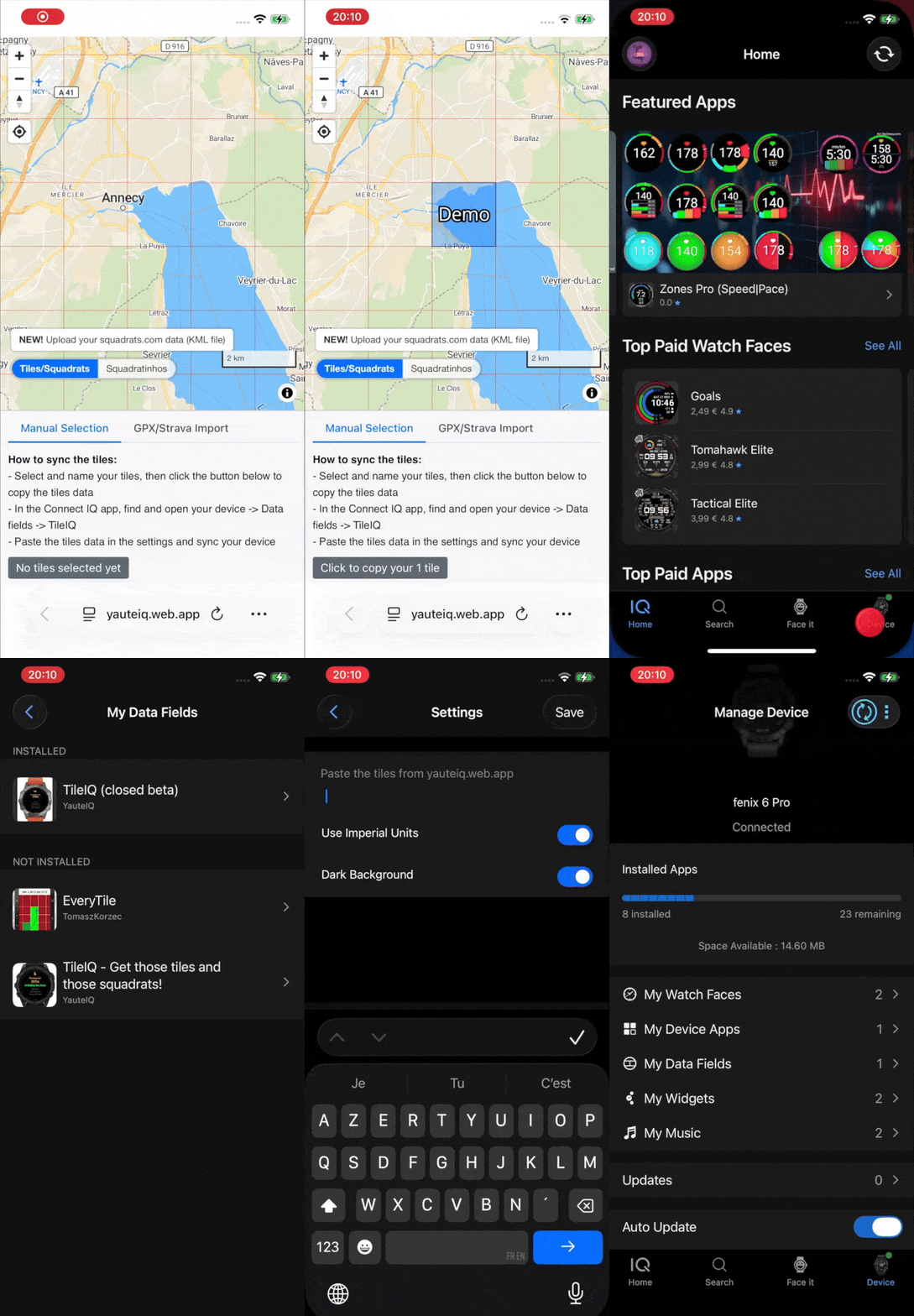
The list of tiles is now available in the text box at the bottom. Simply click the button to copy it.
The rest happens in the Connect IQ app from Garming:
- In the app, find and open your Garmin device.
- Navigate to Data fields.
- Select and open the settings for the TileIQ data field.
- Paste the text list you copied into the settings field.
- Sync your device
- Go get those tiles!
Happy Tile Hunting! 🗺️